


This week, three states need to prepare for a serious weather event as a major atmospheric river rolls into the Pacific Northwest, bringing unprecedented waves, fierce winds, and considerable precipitation.
According to meteorologist Joshua Wood from the National Weather Service (NWS), this marks the first ‘true’ atmospheric river to hit the region this season, while several lesser storms with atmospheric river characteristics had already made their way through.
Why You Should Pay Attention
Atmospheric rivers act like long, narrow conduits in the sky that ferry most atmospheric moisture outside the tropics, as described by the National Oceanic and Atmospheric Administration (NOAA).
These weather systems typically unleash heavy snowfall, torrential rain, and gale-force winds, with the transient disturbances hitting the West Coast particularly hard as winter rolls in. While they can be beneficial by replenishing water supplies during dry months, they also pose risks such as serious flooding, mudslides, and power outages.
Key Information to Keep in Mind
The NWS Climate Prediction Center has been raising alarms about this looming storm for over a week now. Earlier this week, the NWS Weather Prediction Center released a detailed map illustrating the states most likely to experience severe weather and the anticipated timing of the storm’s effects.
According to their latest Day 3-7 Hazards Outlook, valid from October 23rd to October 27th, a strong atmospheric river is expected to begin affecting the Pacific Northwest by week’s end. This could lead to heavy rainfall, substantial snow at higher elevations, and coastal hazards compounded by fierce winds.
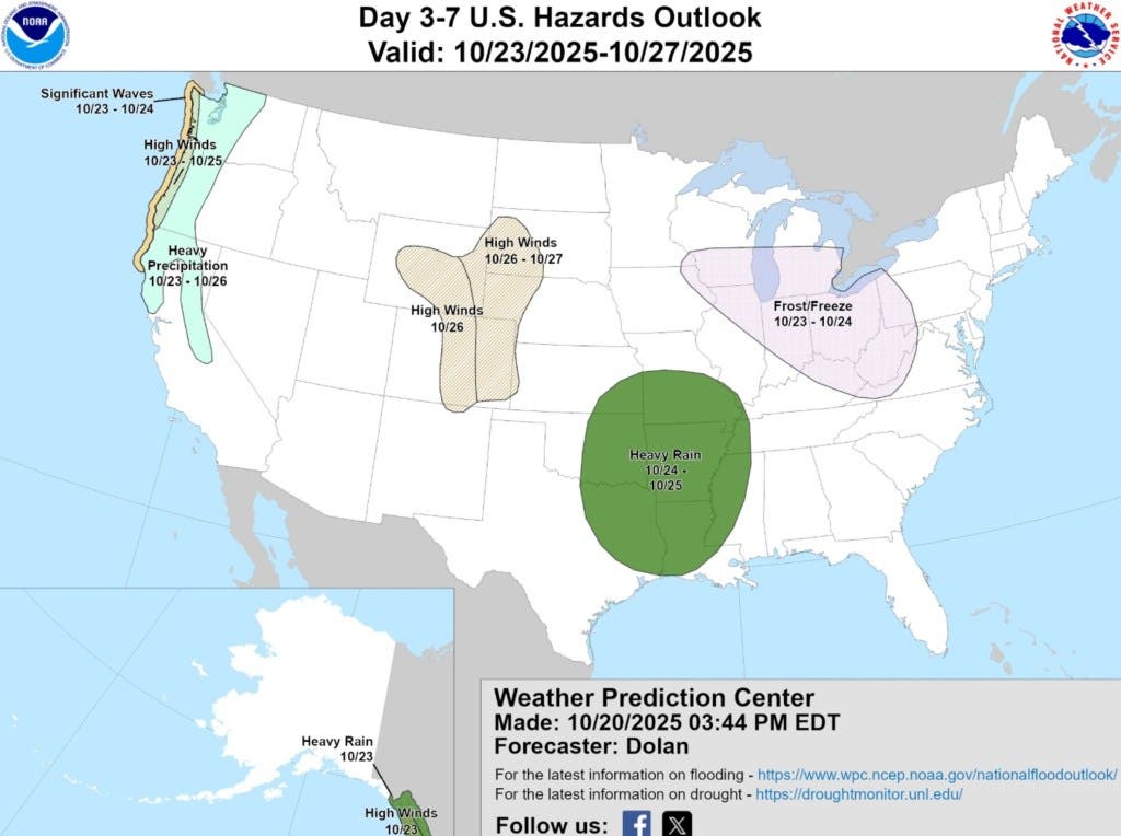
The chart unveils that significant wave activity will batter the coastline of the Pacific Northwest—spanning from Northern California all the way up to Washington’s full coast—on Thursday and Friday. Wind gusts are expected to be particularly fierce along the coastlines of Oregon and Washington from Thursday through Saturday, with widespread rainfall stretching as far down as Central California and affecting Western Oregon and Washington from Thursday until Sunday.
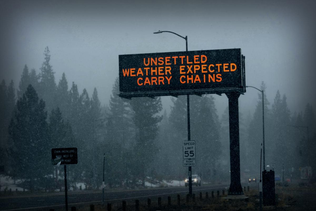
Lower elevations can expect heavy rain while those in high-altitude regions will see substantial snowfall instead.
According to AccuWeather, areas close to the coastline could see up to 4 inches of rain due to this storm.
Expert Insights
Senior Meteorologist Chad Merrill from AccuWeather notes: “The current conditions unfolding from the Northwest down to Northern California are typical of an Atmospheric River. The moisture associated with this system traces back to Southeast Asia. These weather patterns are notorious for heavy rainfall and considerable flooding, with significant snowfall primarily in high-elevation areas like the Sierra due to warmer air mixing in. “
Merrill further explained: “Atmospheric Rivers are most prevalent between November and January, bringing intense downpours over short timeframes. Multiple inches of rain can potentially cause flooding and landslides within a mere 24 hours. This upcoming system at the end of the week is unlikely to be an exception.”
What’s on the Horizon
Impacts from this storm will start affecting the Pacific Northwest Thursday and may linger into the weekend for some regions. Residents in the area should heed local weather advisory updates as the NWS prepares to issue alerts concerning the impending storm.