


Before dawn, a team of scientists embarked on an adventurous journey up Mexico’s Popocatépetl volcano, known for being one of the most active in the world and posing risks to millions of residents nearby. They aim to unveil the secrets that lie beneath this iconic mountain.
Over the past five years, researchers from the National Autonomous University of Mexico have successfully developed the first-ever 3D images of the interior of this imposing 17,883-foot (5,452-meter) volcano. This pioneering work illuminates where magma is stored, which is crucial information that will help authorities respond swiftly to potential eruptions.
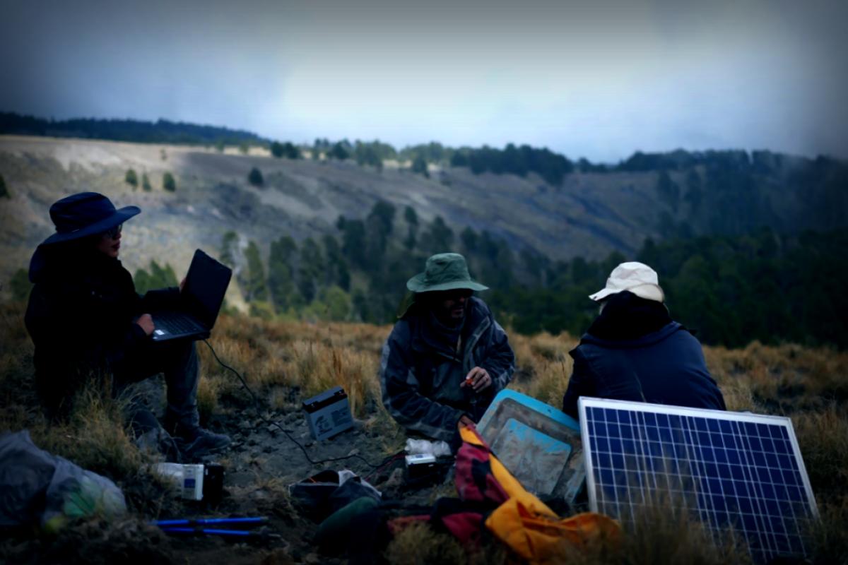
Leading the charge is Marco Calò, a professor specializing in vulcanology at UNAM’s Geophysics Institute. His team faced challenges transporting hefty equipment and mitigating the risks of inclement weather or unexpected volcanic explosions. They meticulously gathered seismic data, utilizing artificial intelligence to analyze what they had collected. The Associated Press was on board for their final journey before the results are formally shared with the public.
Many volcanoes globally that threaten human life have comprehensive maps of their interiors, but not Popocatépetl. Given that around 25 million people live within a 62-mile (100-kilometer) radius—where homes, schools, hospitals, and five airports exist—such knowledge is critical.
While other scientists attempted to create images of the volcano 15 years ago, their findings were inconclusive and low-resolution, leaving questions about how this majestic structure was formed and where magma was situated.
Calò’s team expanded the seismograph network from 12 to 22 to cover the volcano’s perimeter, allowing for a clearer understanding of the seismic activity. Even though only three seismographs may signal an emergency, having more data points greatly aids in comprehending the events leading to eruptions.
These instruments record ground vibrations 100 times per second, and doctoral researcher Karina Bernal, 33, optimized the analysis using adaptive algorithms drawn from observations of other volcanoes. “I educated the machine on various tremors from El Popo,” she expressed. Gradually, the scientists could deduce which materials were present and under what conditions.
The resulting blueprint reveals much more than those typical illustrations we learned about in school; it indicates a main vent linking a magma chamber to the surface, and panoramic views show several magma pockets at varying depths.
Popocatépetl initially arose in the crater of previous volcanic activity over 20,000 years ago, and it has remained active since 1994, frequently releasing plumes of smoke, gas, and ash. Eruptions usually reform a dome above the vent, which eventually leads to collapse and new eruptions—a process that occurred last in 2023.
Calò, who hails from Sicily, affectionately refers to Popocatépetl as “El Popo,” sharing interesting tidbits about its history. The volcano’s height fluctuates due to eruptions, and in the first century, volcanic activity buried the village of Tetimpa in ash. In the early 20th century, human attempts to harvest sulfur induced an eruption. Notably, while El Popo emits substantial greenhouse gases, these are dwarfed by emissions from nearby Mexico City.
After years spent examining volcanic activities from his computer, Calò’s disappointment in not experiencing the process firsthand motivated him to investigate Popocatépetl directly.
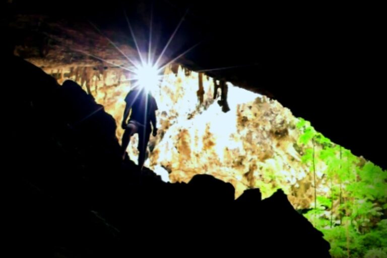
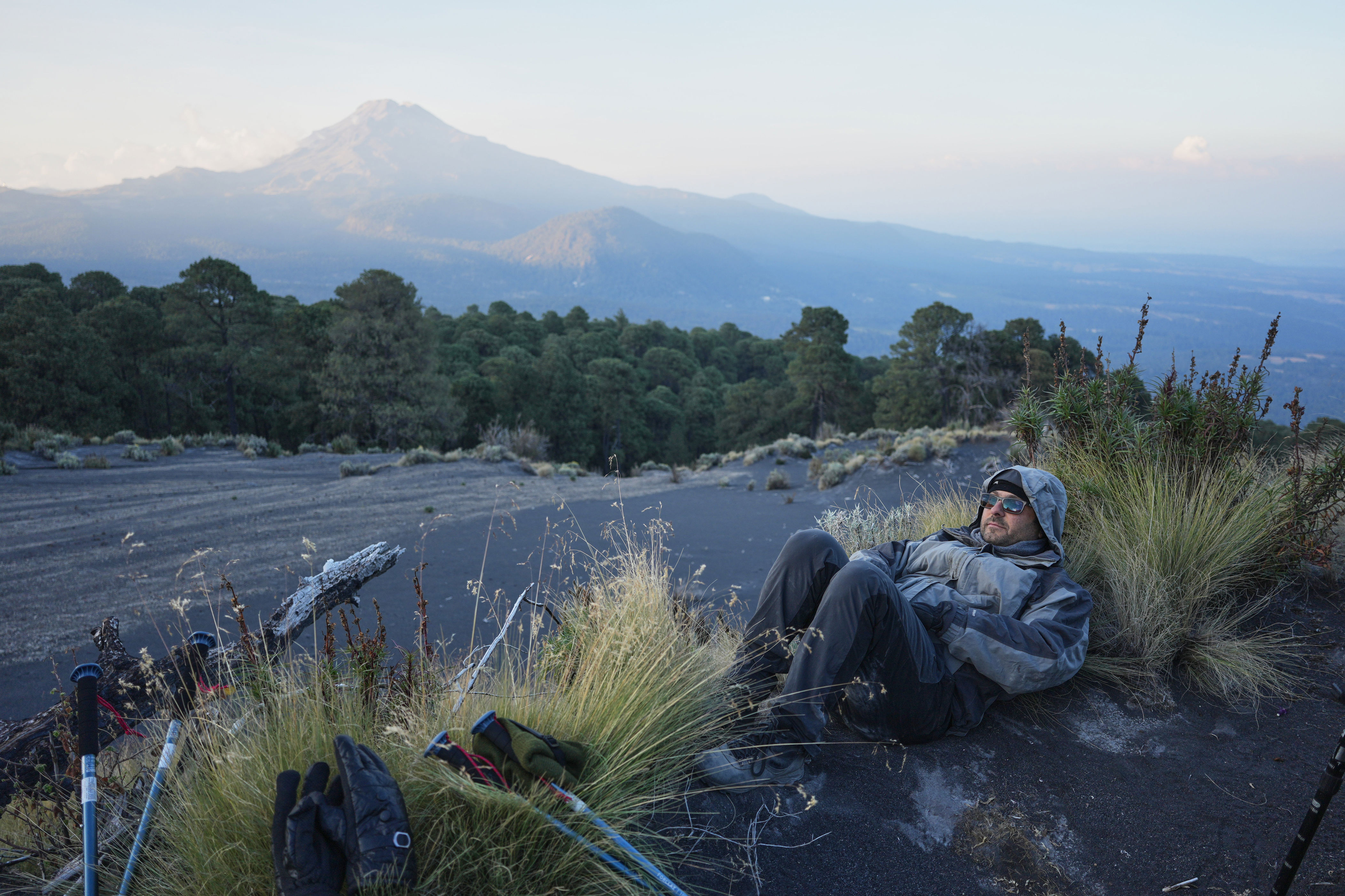
After trekking several hours up the slopes, Calò’s research team established camp in a pine grove around 12,500 feet above sea level—a seemingly safe haven from potential pyrotechnic disasters, as the trees attest to being shielded from previous eruptions.
As they ascend, lush vegetation gives way to ash and sediment, necessitating crossing a dangerous lahar—a rocky ash mixture transforming into a perilous mudflow during rains. The now-arid terrain offers breathtaking views: to the east lies Pico de Orizaba, Mexico’s tallest mountain, while to the north, Iztaccíhuatl resembles a dormant giantess known as “the sleeping woman.”
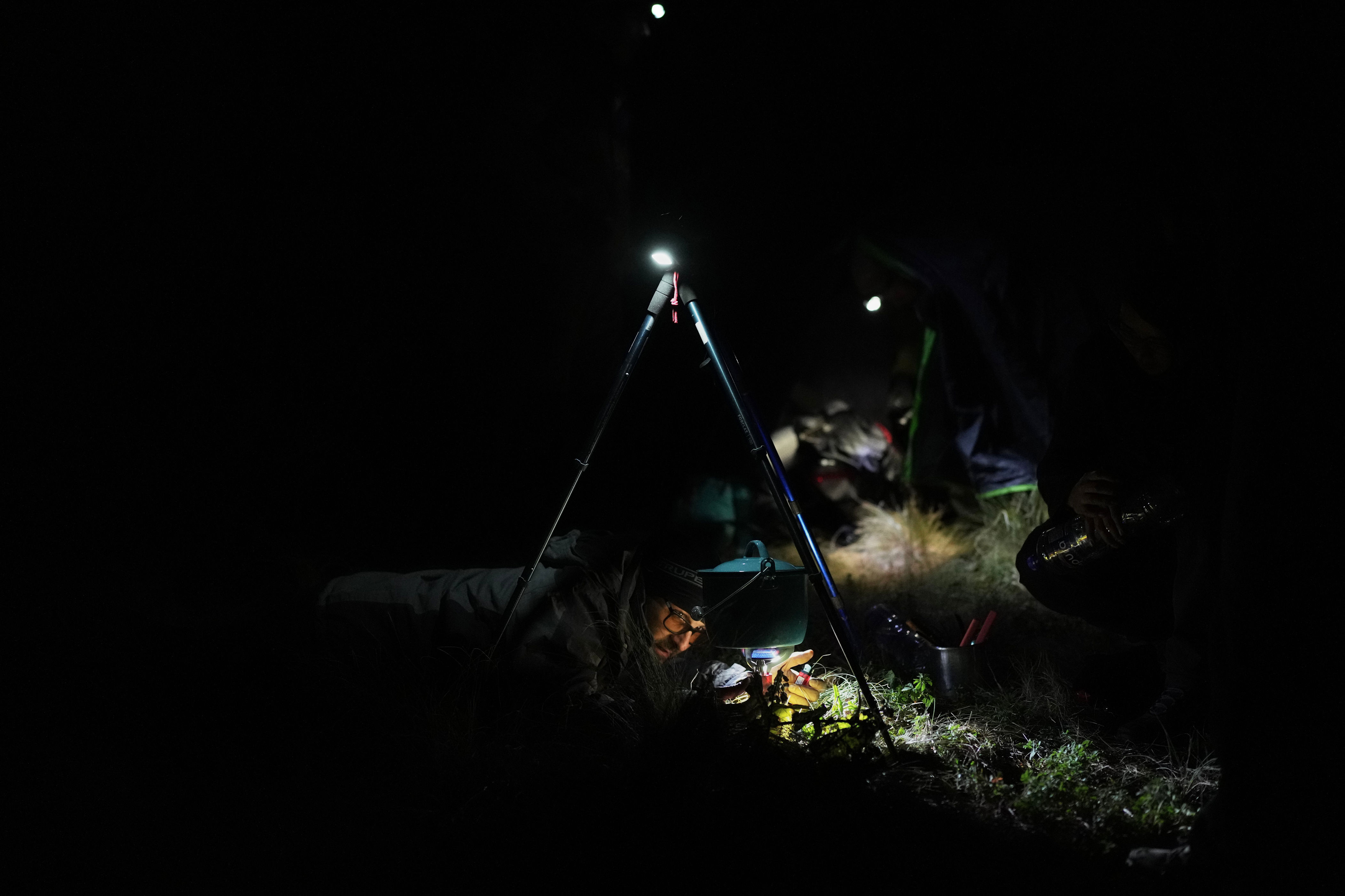
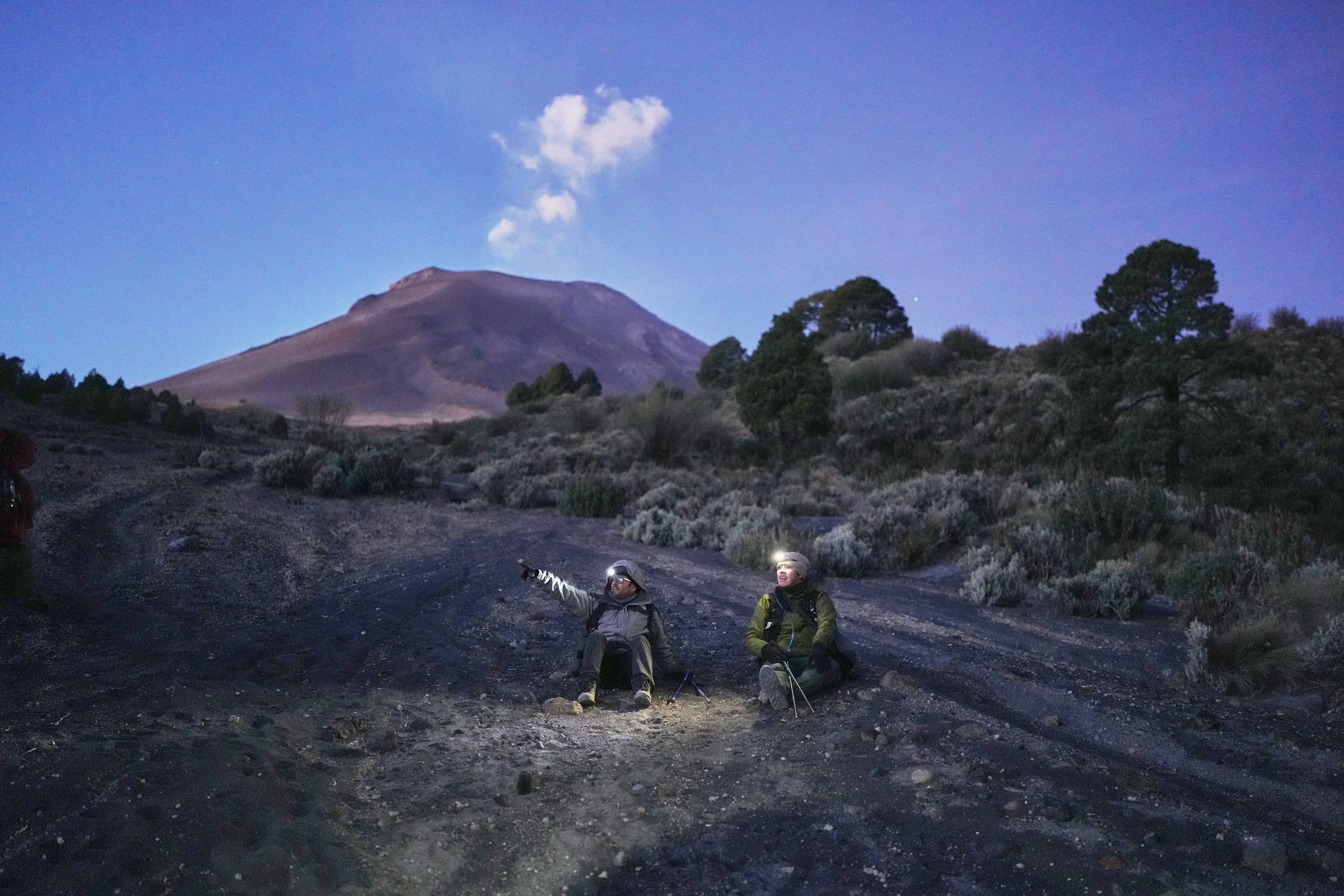
When night descends, Popocatépetl enchants with its symphony of sounds that blend and reflect off the surrounding vistas. Reports of small tremors often surface along with the sound of slowly falling ash or the booming explosions that echo from the crater—creating a mesmerizing gallery of sensations, especially when the perimeter of the crater emanates an electric orange glow.
By immersing themselves in the world of volcanoes, the team can provide valuable insights into the volcano’s dynamics. “This natural lab is crucial for us to grasp and inform residents about events happening within the volcano,” Calò emphasized.
At elevations of 13,780 feet (4,200 meters), carrying their gear becomes heavier with each step, but their determination remains unfazed amidst the lush landscape dominated by dark, warm ash.
During one of their stops at a seismographic station, they uncovered the equipment still operational, celebrating this brief victory before reinserting it below ground level.
A massive volcanic bomb—a rock the size of a yard—sits in stark discord with the surrounding terrain, a clear reminder of just how environmentally challenging a real eruption can be. Only certified personnel should navigate the upper terrains, but restrictions often go ignored; in 2022, someone tragically died after being struck by falling debris 300 yards from the crater.
A curious bottle of tequila discovered near a rocky depression labeled as El Popo’s “belly button” hints at local rituals, including an annual pilgrimage to this otherworldly connection point.
When it came to unearthing the last seismic station, a grim revelation greeted Calò: the last recorded data was months old, due to a failed battery. Nature can impede technology; rodents chewing wires or volcanic eruptions unleashing chaos are constant threats.
The project showcased definite insights but opened up fresh questions to probe, including why tremors appear to be more frequent in southeastern regions where magma is particularly ample.
This marked their final mission before publicizing their findings from years of tireless research. Observing the intricate interplay of the volcano’s substance through 3D software affirmed the objective’s worth.
Feeling that unwavering sense of accomplishment and intel further fuels the drive for future inquiries, as expressed by graduate student Rodríguez: “Experiencing how all our efforts transcend into something tangible ignites the journey towards new projects.”